To discover some of the most picturesque moorland, crystal clear rivers tumbling over grit stone, lush pastureland and woodland in a valley setting and also reservoir scenery, then the Goyt Valley in the Peak District National Park combines the lot.
Goyt Valley is located between Macclesfield and Buxton and close to the Cheshire and Derbyshire County border. The River Goyt flows through the valley and rises high on Axe Edge Moor near The Cat And Fiddle pub, and flows north through Taxal, Whaley Bridge and New Mills before joining the River Tame, near Stockport to form the River Mersey.

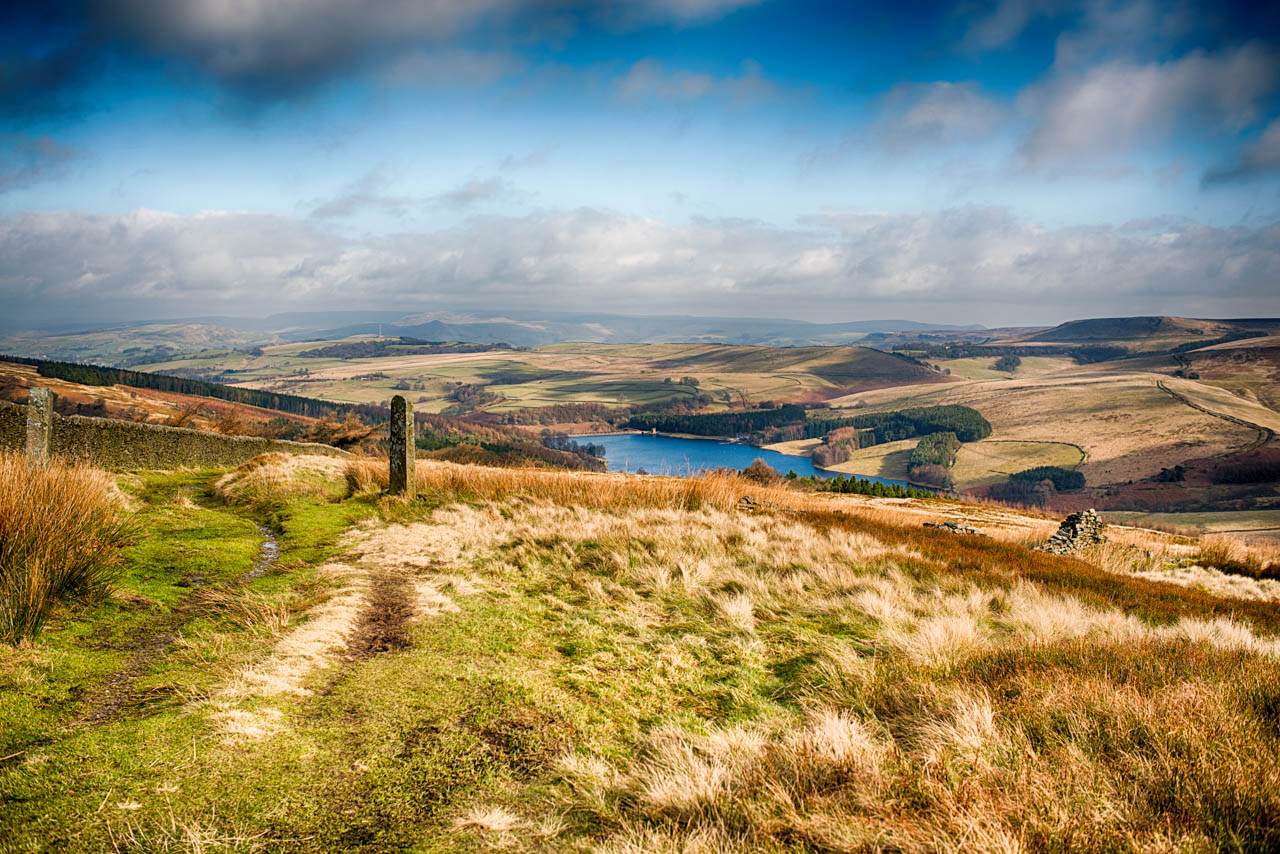
There are two main reservoirs in the valley, the larger called Fernilee and the smaller, Errwood, which both provide drinking water to Stockport and its surrounding areas. Along with sailing and fishing, it is a popular destination for cycling, horse riding and walking, with a landscape varied between a mixture of bleak heather moorland and wooded valley slopes which change wonderful colours with the seasons.
Wonderful wildlife such as red Deer, badges and foxes, hedgehogs and bats live together in harmony with the number of birds, including woodpeckers, nuthatches, lapwings and birds prey as well as grouse, canada geese and finches. The wood is managed by the Forestry Commission and the Peak District National Park authority and the woods have oak, rowan, larch and pine, making it a fantastic place in all weathers.
Erwood Hall

Erwood Hall Ruins
The Grimshaw family of Errwood Hall had a major influence on the valley in the 19th century and they were responsible for bringing prosperity to this very small community. The mansion was built around 1840 and stored until the 1930s when it was demolished to make way for the reservoirs and avoid pollution. Now all that is left are the remains of the hall, its base nearby the Grimshaw family cemetery.

Glimpses of past life remain in the valley, including the romantic ruins of Errwood Hall, and also the paths which follow the route of the Old Cromford and High Peak Railway Line and the Goyt Clough Quarry. Before the reservoirs were built, the Valley was home to a thriving community with many farms, the railway, coalmines, a school, and even a gunpowder factory and paint works, but hardly any of this is still in existence and even the most imaginative visitors will find it difficult to picture how the area must have looked back then.
The shape of the valley has been formed over millions of years through ice ages and by the stunning River Goyt which cuts like butter through the valley. The name Goyt is thought to come from the word ‘goit’ which means a channel for water or a stream from the old English word ‘gote’ or ‘gota’.

Since Victorian times the valley has been a popular tourist destination and in the 19th century visitors may have walked along the river, where there were tea rooms in the hamlet of Goyt’s Bridge, and stood and marvelled at the spectacular suspension bridge which once crossed the river. This bridge has long been demolished but there is still the old packhorse bridge near Goyt’s Clough Quarry, which was reconstructed after it was removed to make way for the Errwood reservoir.

There is a local legend that a highwayman called Pym used to lay in wait to ambush those who used the packhorse route, hence the Pym Chair, and although it is also thought he was a preacher who gave sermons here. Derbyshire Bridge is the famous packhorse bridge which adorns many Peak District postcards, about 450 yards from the Derbyshire bridge car park and it is so called because it used to be where the County boundaries of Cheshire Derbyshire met, but today the boundary is further to the West.

Farming has always played a part in the history of Goyt Valley and the remains of many farmhouses remain but still graze in the valley today, even as high up as The Cat And Fiddle, England’s second highest public house at 1690 feet or 515 metres above sea level, which is nearby. It provided refuge of the travellers when it was built towards the end of the 18th century and has done ever since. Jenkin Chapel nearby, the church of St John the Baptist just to the west of the valley and was built in 1733 by local farmers who couldn’t get into town.
In summer the rhododendrons are a sight to behold with a sea of colour around the hall with sheltered tables in some areas ideal for a summer picnic. In Autumn the moors turn purple with the heather flowers, and the leaves on the trees turn magnificent shades of scarlet, burnt sienna, oranges, yellows and reds before they drop and if you can get there in the winter, it is a great place for a walk with extremes of weather from cold, frosty mornings to dense fog and also heavy snowfall, so go prepared for anything!